Showing posts with label Cordillera Blanca. Show all posts

Saturday, February 27, 2016

Seeking: mountaineering partner for Aconcagua 2018

Seeking: mountaineering partner/s interested in the South American Andes between about 15 and 40
To  Plaza de Mulas, the climbing base camp.
degrees South (i.e. Altitudes of more than 6,000m/20,000 feet, relatively little snow or glaciers). 


My objective: to climb Aconcagua in Argentina in 2018 (summit just short of 7,000 m).

I'm looking for people to plan, train (think epic Yukon treks, long Eastern US/Canada through hikes, trips at altitude) and climb this impressive mountain. Regular climbing season on Aconcagua runs from mid-November to mid-March. The trip takes about 3 weeks, but I'll need more time to acclimatize and likely would do so in Bolivia's high mountains. Intrigued? Interested? 
The Polish route sen from Plaza Francia
(not considering that one so much)


Check out:


You'll see, Jan, my long-time partner in life and the mountains in many of these posts. Unfortunately, that partnership ended last year, so I am looking for a new 'travel in high places' partner.


Message me here and let's talk!

Aconcagua Normal route seen from Plaza de Mulas
at about 4,450 m. Summit at 6,962 m (22,840 feet)


Thursday, November 24, 2011

Red Book Entry: October 29, 2010

We went over our last pass of this phenomenal trek shortly after leaving our camp at 4,500m. I am not sure what was going on with my belly but it felt as if I had five portions of breakfast. I had woken up around 6:30, no longer starving. Perhaps my body was a bit overworked trying to stay warm having to get up four times during the night to go to the bathroom. It sure is hard to drag myself out of my warm cocoon into the cold night. The bonus, however, is seeing the phenomenal night skies; brilliant black speckled with dazzling stars (I don't know constellations in my part of the hemisphere let alone those in South America -- suffice it to say that the stars are impressive) and a waning moon (which was still with us in a bright blue sky as we headed out of camp at 8:00).

We just got to camp on time as it started to hail and to hail and to hail, accompanied by strong winds. Talk about feeling among the elements. From our tent we looked out onto glacier capped moutains. I walked about when there was a break in the weather and was seduced by the mountains -- all I had to do was descend into the valley and up the other side -- so seemingly within reach. But so not.

Breakfast was outside today; the morning was the complete opposite to the night. The coffee was strong, the oatmeal pipping hot and, as with all the other mornings, the company was superb.

Tuesday, November 22, 2011

Red Book Entry: A Little Tune

Libre como el aire
Libre como el viento
Como las estrellas
En el firmamiento

I learned this sweet song several years ago in my flamenco class (to practice palmas). It has been the perfect refrain while trekking in these amazing mountains.

LIBRE : FREEDOM

Red Book Entry: October 28, 2010

I have been recording the trek day by day as I find it overwhelming to try and capture all that I see, all that I experience and all the emotions that move through me.

Each encampamiento has been unique, as have the valleys we have crossed and the paths we have climbed. The camp we are at tonight, our second to last, is by a small lake and across the valley from massive glacial peaks. It feels as if I could reach out and touch them.

We made it to camp just on time; it started to hail. It did not last very long (or so I thought) as it started over, only this time in the form of rain. I am not sure if I heard thunder or if it was an avalanche in the distance. There is quite an echo in the mountains, making it hard for me to discern distances.

It will soon be tea time. I look forward to a hot cup of tea (I usually go for the mate de coca) on this damp afternoon. We are certainly treated extremely well by the kind team of people.

I am not bothered by the rain at the moment. We had awoken to a sun filled and blue sky day. And this sky graced us during our whole trek. Hopefully we will have the same luck tomorrow on our second to last trek. One more pass and then it's downhill from there!

Sunday, November 20, 2011

Red Book Entry: October 25, 2010

We are at the end of day five of our amazing trek. We started earlier today, with breakfast at 7:00 (the delight this morning, along with the "usual" pot of coffee, was a hot cereal made with rice). I did not know that rice grew in Peru, as does just about everthing else.

The beginning of the trek was quick to get your attention as it rose from 4,250m to 4,850m. It was a splendid morning again (I am touching wood that our luck will continue) with the sun "turned on", the sky a gorgeous blue and Alpamayo in full view.

We were soon met by the arrieros, burros, horses and our cook extraordinaire. They do an amazing job taking down camp, packing the animals, getting to the next camp and setting it all up by the time we arrive. Very, very lovely people.

After another delicious lunch at the top of our second pass, we arrived at camp at 1:30ish. I washed some clothes and a few body parts in the cold river then explored the area with Inga. I don't know how I could have, but I forgot to mention that we walked through a herd of grazing alpacas just before reaching camp. There are three colours of alpacas: white, black and brown.

Our "usual" four o'clock tea with Eli was pleasant and informative. He brought out the map and we looked at the trekking for the next few days. Popcorn was the treat served up today and, because I tend to have a good appetite, I enjoyed two bowls.

It is now the post treat "tent time" to rest and catch-up with writing or reading before supper at 7:00. What a peaceful rhythm.

Red Book Entry: Mountain Menu

Desayuno
  • Flacky pastry stuffed with apples and cinnamon
  • Fresh banana (one of three varieties grown here)
  • Lactose-free yogurt drink
         _______________
  • Pancakes
  • Coffee (Peruvian, of course)
         _______________
  • Toast with honey or jam
  • Oatmeal
  • Coffee
         _______________
  • Fresh mango and kiwi
  • Yogurt drink and granola
  • Coffee

 Almuerzo
  • Quinoa salad (red onion, nut of some sort, herbs, tangerines ...)
  • Super delicious because it was eaten on a mountain
  • Juice
         _______________
  • Make-your-own sandwich with hommus, cucumber and carrots
  • Mate de coca
  • Tangerine
        _______________
  • Make-your-own sandwich with cheese (cow, incredibly fresh),
    avocados!, tomatoes and boston lettuce
  • Mate de coca
         _______________
  • Crackers with peanut butter (Humberto was not with us : (
         _______________
  • Boston lettuce, yellow potatoes, olives, sauce
  • Mate de coca
        ______________

Saturday, November 19, 2011

Red Book Entry: October 21, 2010

Ready, set, trek! Some members of our adventure team picked us up at Albergue Churup at the bright and early hour of 6:15. Inga and I had packed everything the night before and had a shower (the last one for 10 days) so we were all set to go in the morning.

The van was filled with everything the six of us would need for the next 10 days. Our packs, not having been this light for quite some time, were added to the food, the "bathroom" tent; the cooking tent; the eating tent; our guide Eli's tent, and the combination tent for Humberto, the cook, two arrieros and supplies. After the paperwork was complete, we dropped off Ted, the Skyline rep, and headed to the mountains.

Our adventure team of Eli, our kind and very knowledgeable guide and leader; Humberto, cook extraordinaire (vegetarian cooking was not a challenge for him); the super sweet arrieros and a full complement of four legged friends: five mules, three donkeys and two horses.

The three-hour van ride to the trailhead was an adventure in itself. Vehicles casually drift from right to left and left to right to avoid the many potholes. We stopped along the way to have breakfast on the side of the road, and what a satisfying breakfast it was! A flacky pastry filled with apple and cinamon (and not too sweet at all), a lactose-free yogurt drink and a banana grown right here in Peru. A very fine start to Humberto's delights.

And then there was the drive up the mountain; the dirt road was very (very) narrow and had rocks and bumps to add to the thrill. Up and up we went past fertile fields of corn, potatoes, alfalfa (the food of choice for guinea pigs) and other vegetables that I did not recognize. What hard working people they are. Fields are tilled by bulls and harvest is done by hand.

We started the hike while the arrieros, with some help from Huberto, packed up the gear and the donkeys and one of the horses. We walked slowly in the splendid sunshine and my mind was blown. I can't believe where I am and all of the splendour I have seen. And this is only the beginning of the trek!

I am enveloped by the mountains.

Saturday, December 4, 2010

Quechua people and their Inka

One thing we learned in Cuzco is that "Inka" is the title of a ruler; like Queen, Kaiser, Ceasar or Emporer. The people this Inka ruled were Quechua. Still to this day, many Quechua-speakers live in Peru, including in the more northern parts like around Huaraz.
Cusco - temple of the sun/convent in dramatic light.

Inga at one of the Inka sites near Cusco.


It´s amazing that with all the knowledge these people had, they did not develop a written language. Today, it is possible to learn Quechua in university - so you don´t have to be a native speaker learning it all at home from parents and grandparents. Its written language is based on Spanish, with a few more accents to denote the different sounds the language has.
Rock on rock - always in synch with what was there

Valle Sagrado. One of strategic Inka cities with 65,000 ha of terrasses.
Same site, new view.
Inga at Ollantaytambo.

Looking pleased. The building mid-mountain is a grainery
There were 14 Inkas (if I recall correctly). The Spanish could take over the empire so easily in part because it was in internal chaos: yes, the usual power struggles between the Inka´s off-spring.
View over the Cordillera from Chincero

Our team in Huaraz was Quechua. And the guides we had around Cusco were mesquites (mix of Spanish and indigenous).


:)

Sunday, November 21, 2010

Farm animals in Peru and Bolivia

Yin and yang finding out about
life together. Lamb is a staple meat
and we saw many flocks along
our travels.
Livestock farming in the Andean regions of Peru and Bolivia is very different from what I am familiar with in Canada. The biggest difference is in how the animals are raised. Communities or families have herds of llamas, alpacas, cows and sheep that graze freely in the mountains (no fences in these parts). The animals are rounded up once a week or so by the herder to make sure that they remain in the right valley and to guard against poaching (the value of animals being what it is, they are unfortunately stolen). All of the animals are branded for easy identification, but alas, this does not protect against thievery.

During our trek through the Cordillera Blanca in Peru, we encountered farm animals in every valley. In the Cordillera Real in Bolivia, communities are deliniated by valleys and are often separated by glacial rivers. Trekking through the vast lands and up and over passes is just part of what a "campesito" does. It was quite inspiring (and humbling too), to witness the physical strength and determination of the people.

Horses are a big part of life in the
Andes. They are essential
for transportation and as pack
animals. Here they helped us
across a river.
Donkeys are also integral to life in the Andes. They can
carry up to 40 kilos (25 more than llamas). Such gentle
animals they are.

Alpacas make you just want to smother yourself in
their fur. The white ones are more "valuable" than
the lovely brown ones. Alpacas are raised for their
fabulous fur which is used to make many garments,
from hats and gloves to gorgeous sweaters. Warmth
and beauty combined.

Alpacas graze freely on grasses.
There are several varieties of llamas. One variety is best for its meat (they
have less fur so are valuable for the food they provide), while another
variety has more fur, making them valuable for their fur "harvest". Their fur
can be shorn twice a year. Both varieties can give birth to one llamasita
a year. Llamas are gentle creatures and a spectacle to watch as they
effortlessly bounce up and down steep faces. 

Living High

Our first pass over 5,000 m (ever!) on
Day 3 of our Cordillera Real trek.
When Jan and I planned this trip, we wanted to be in the Andes, the second highest mountain range in the world. That meant we would be spending a lot of time in really high places. Working out an acclimatization process that would get us to be healthy while high would be key to our enjoyment.

So here are  a few tips for aspiring altitude travellers, gleaned from what has worked for us (of course, everyone reacts a little differently to high altitudes, so take this as food for thought):
    1. Take your time to acclimatize properly. We took 7 days with acclimatization hikes (ie hike high, sleep at 3,000 m), lots longer than any of the commercial trips offered in the Cordillera Blanca. They are set up to fit the typical 2 week vacation after all. 
    2. Take a tylanol if you get a headache. Diamox is a favourite drug to take to help people with altitude issues, but it is also a diuretic and as such counter-indicated for altitude issues. If you can take a few days to get used to being high then a tylanol is probably a fine option.
    3. Drink water. It is the best medicine against AMS symptoms. Naturally, do not over-hydrate. And until you acclimatize try to keep away from alcohol ... no fun, I know.
    4. Take responsibility for your health and don´t blame your tour operators or guides if you get AMS symptoms. Just because they offer a particular itinerary doesn´t mean you need to follow it. You kow yourself and you get to make sure you have a great time!
    5.  
      Huayna Potosi in the late
      afternoon light of day 8. The next day
      we walked to Base camp around the
      mountain.
    5. Look at the elevation of specific treks and mountains you want to tackle and then plan your route. While the mountains in Peru´s Cordillera Blanca are a bit higher than in Bolivia´s Cordillera Real, the trekking is actually lower in Peru than in Bolivia! Make sure you understand the heights each trek/climb will get you to and then plan your itinerary accordingly!
    6. And take some time to understand the climate specific to the mountains you want to visit. We noticed that 4,400 m on Aconcagua is a totally different experience than 4,400 m in the Cordillera Blanca: Aconcagua is an arid desert while in Peru the tropical climate is far moister and animals graze up to 4,800 m! Guess which is easier on the human, then?!
In the Cordillera Blanca we slept between 3,600 m and 4,600 m. But in the Cordillera Real, we slept most nights at 4,700 m. The reason is that the Cordillera Real is sitting on top of Bolivia´s Altiplano (High Sierra) which is at 4,000 m! There is no low. Simple. This also means that the hiking in Peru covered a lot more elevation changes - we had 4 days with ascents of over 1,000 m - while the trekking in the Cordillera Real was "flatter"; we would ascend 600 or 700 m in a day. But all of our time was spent hiking between 4,500 m and 5,350 m.

This is the final path to the top of
Huayna Potosi. See the steps at the edge of
the snow and rocks? Just above that
was the summit. (Pedro´s head is here just for scale.)

So when you plan your trip, find out how high you will sleep, how high you will hike and how much elevation change you will cover. Then you can sort out the best plan for you.

Saturday, November 6, 2010

Los Cedros stats

I know, I know: statistics are only so interesting.

So let´s start with the highest mountains in Canada. Yes, there are very tall mountains, but hardly anyone will ever see them, because they are in the Saint Elias Range in the Yukon. The highest is Mt Logan at 5,956 m. Impressive. This range has 5 mountains over 5,000 m and all but one of Canada´s over 4,000 m high mountains are in this range; the exception is Mount Waddington in BC which comes in at 4,019 m.

So, what´s the highest mountain some Canadians might actually travel to, let´s say in the Canadian Rockies? If you guessed Mount Robson you win! It´s 3,959 m.

Similarly, the highest mountain in the Alps that many might see from Chamonix is Mont Blanc which comes in at 4,808 m.

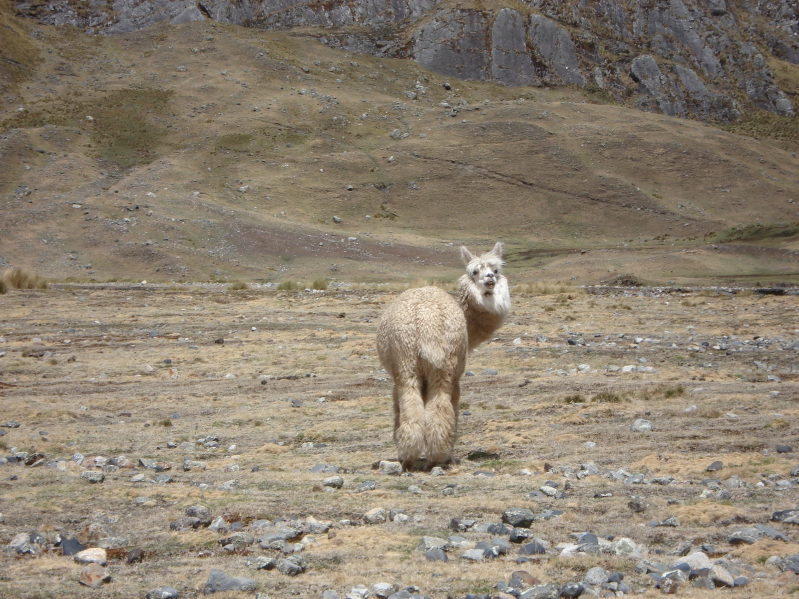
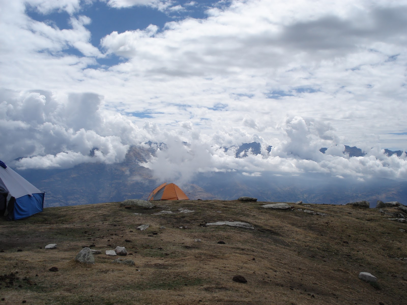
Now that we have some context established, here are our stats for the Los Cedros Trek. In brackets is the day´s ascent and descent rounded - you´ll note a lot of up and down. Anyone looking to do this trek or similar ones in the Cordillera Blanca might find some inspiration here.

Camp 1 Huishcash - 4,320 m (asc 1,200 m des 75 m)
Camp 2 Osoruri - 4,600 m (asc 700 m des 500 m)
Camp 3 Jancarurish - 4,250 m (asc 600 m des 900 m)
Day 4 - "rest" day at Jancarurish (asc/des 550 m)
Camp 4 Huillca - 4,100 m (asc 1,000 m des 1,200 m)
Camp 5 Janca Pampa - 3,600 m (asc 800 m des 1,300 m)
Camp 6 Huecrococha - 4,050 m (asc 1,100 m des 650 m)
Camp 7 below Taulliraju glacier toward Punta Union pass 4,500 m (asc 1,000m des 550 m)
Camp 8 30 min above of Llamacoral - 3,950 m (asc 600 m des 1,100 m)
Hike out (asc 50 m des 950 m)

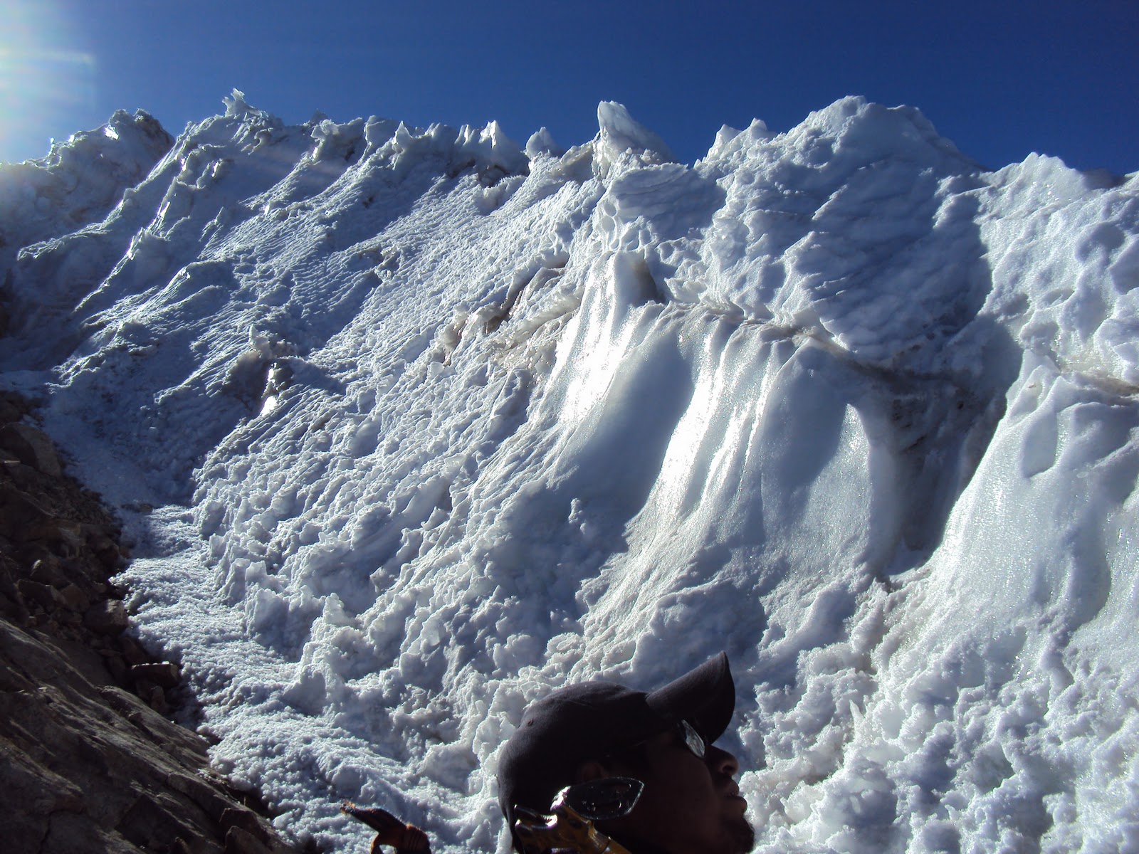
The passes are higher than our camps. The highest was the very first one at 4,850 m. That was followed the next day by a pass at 4,750 m. After our rest day, we tackled two passes: the next big one 4,830 m followed by a much lower one at 4,460 m. Rounding the estern end of the Cordillera we passed over 4,600 m and 4,400 m passes. The last pass (Punta Union) got us back up to 4,750 m before heading downhill over 2 days and 1,800 m in elevation.

See, stats aren´t so bad :)

Friday, November 5, 2010

Cordillera Blanca - 6,000+ metre mountains

Alpamayo from our camp site.
We spent 10 days trekking in the Cordillera Blanca near Huaraz in Peru. The Cordillera runs over 200 km in length and maybe 40 km in depth. We had picked the Los Cedros trek which is a circumnavigation of the most northern part of the Cordillera´s 6,000+ metre peaks. The greatest benefit of this trek is that we were in view of the big mountains every day! Other treks like the popular 4-day Santa Cruz trek goes through very narrow valleys and the 6,000 m mountains aren´t in view much of the time. Plus, the last 2 days of Los Cedros is part of the Santa Cruz trek anyways.

Jan at this huge laguna, used for
hydroelectric generation on Day 2.
Fed by glaciers of the Santa
Cruz mountains.

Alpamayo is probably the central peak on that trek because some German alpinists declared it the "most beautiful mountain in the world" due to its perfect pyramid shape. Peruvians are happy to repeat the claim any chance they get, of course! Also, you can see it on about 4 of the 10 days from various sides.

Floating mountain top (Taulliraju) -
Day 7 as we complete the eastern
circumnavigation and are heading
back toward the beginning.
Lagunas and water falls fed by the glaciers were plentiful. Mountains over 5,500m have glaciers here. But due to climate change glaciers in this region have receded 30% over the last 30 years and there isn´t as much snow either anymore. Some mountains that used to be technical in terms of ascents, have turned into walk-ups as a result.

View from Janca Pampa
camp site (the only one outside
of the national park) of
majestic Taulliraju. Day 6


Inga in front of first views
of glacier feeding a huge
water fall and gorgeous laguna. Day 2

Taulliraju and our camp at 4,500m
on day 8. This is not the main
face. That came the next day
after we crossed the
Punta Union pass.

Day 10. The hike out follows the
Santa Cruz trail in reverse, ie
downhill :) The valley gets very
narrow until the two sides are just
a few metres apart.

The trek we did is almost a complete circuit; we just missed the portion on the front of the Cordillera between Hualcayan and Cashapampa. We were above 4,000m every day, with camps between 3,600m and 4,600m. Passes ranged from a high of 4,850 m to a low of 4,400m. We started the trek in Hualcayan at 3,100m and finished in Cashapampa at 2,900m.

Cordillera Blanca - our team

The 4-legged team.
To be 10 days in the mountains is impossible for us to do alone - too much to carry in too many high places. Our team was a self-sufficient crew of 4 people: our guide Eli, our cook Humberto and two arrieros (donkey drivers). We also had 5 donkeys and 3 horses, which included a spare - just in case.


Punta Union pass - they went the
same route we did - just faster!

We used the horse once: for a river
crossing! (I look bulky because I have
my day pack underneath my rain gear!)
Between our very knowledgeable guide - from the mountains to medicinal plans to spotting wild life and fossils, our artful cook - he made amazing meals on that two burner stove - and our arrieros who took care of all things related to the camps and of course the 4-legged support - we felt very well taken care of.


A great team!
 Skyline Adventures put the team together for us and took care of logistics. We just showed up at our hotel door at 6: 15 am and off we went!

Back to the future ... Cordillera Blanca trek - flora

We´ve been wanting to post more on our amazing time in Peru and on the Los Cedros trek in the Cordillera Blanca. But La Paz has taken over! Anyhow, here are a few of the amazing flora shots Jan took during the trek. (More to come on the scenery, trekking and camping, too.)

Hope you enjoy the beautiful plant life that exists above 4,000 metres in these tropical latitudes of the Andes! (As always, click pics to view larger)
Yes, this is an orchid. Our guide
said so!
Cactus in bloom.

A large flowering tree.

Never ending variety!
Many of the plants (sometimes the flowers, sometimes the leaves or roots - and often during specific times of the plant´s life) are used for medicinal purposes by the local people. Too bad much of that knowledge is getting lost here, too.

Saturday, October 30, 2010

Los Cedros trek: Recommend!

Camera batteries are running low. So here are some more pics from my camera ... Enjoy. We did!

Oh, and Jan F., the donkies are on their way!
That is us at the top of one of
many passes - the highest was
4,850 metres.

Being right  in the mountains every
day is pretty awesome.


This day saw us crossing 2 passes
and hike to beat the rain. It worked!
So on to laundry and cleaning up.
We came down from the mountains to
Janca Pampa, our lowest camp at 3,600m

Janca Pampa is a fertile valley with
herds of goats, sheep, cows, horses
and a few farming families. The local
rooster and hen woke us up by doing
their morning thing right beside our tent.
Getting ready in the morning: first stop
breakfast in the dining tent (big blue tent).
Jan is looking great and ready to get
going for another fine day of trekking.

Awesome Cordillera Blanca trek

We got back from our 10 day trek in the mountains. So many impressions, so much to say about this time. Alas, for now here are some pics to peak your interest. Must pack up tonight as we are taking the bus tomorrow morning (eight hours) to head back to Lima for one night before flying to La Paz to meet up with Esther and Miguel! I cannot believe that we will get to hang out together where the lovely Esther grew up. Pretty special.
First campsite (Huishcash) at
4,320 metres. Slept well in the grandeur
of the mountains after a 1,200 metre
ascent.
One of the many glacial waterfalls we
would see over our 160 k trek. Each one
was spectacular.

Lagunas in a variety of awesome
colours dotted the landscape and
provided many moments of
quiet contemplation.


Monday, October 25, 2010

Sunsets are cool

Being in the mountains makes for awesome sunsets. These shots are all taken within 10 minutes or so. Better be ready to shoot when the show is on.
Sunset over the Cordillera Negra as seen from 3,700 m
in the Cordillera Blanca.


The colours are shifting quickly.

Perched on our most lovely dinner spot with a view. 

This is pretty happy stuff :)