Wednesday, September 16, 2015

My first Yukon paddle: Chadburn Lake

My last evening in Whitehorse this September, a friend took me out for my very first paddle in the Yukon. As it was a post-work excursion we kept it simple: flat water kayaking on Chadburn Lake. This beautiful spot is within city limits in Whitehorse. I don't know if it ever gets busy there, but there were just three of us on his lake that evening. We paddled until dark and enjoyed visiting with a beaver, ducks and perhaps even a loon, and each other.

It was a perfect evening.

My ride with my ride - thanks to Up North Adventures for the kayak.
Reflections. Evening Light on Grey Mountain. 


Solitude and silence.

That's me on Chadburn Lake. Thanks for this cool photo! (by Kalin Pallett)

Light and dark as the sun begins to set.

Tuesday, September 8, 2015

Hiking around Whitehorse: Grey Mountain Traverse


Today's GPS tracking points.
https://share.delorme.com/IngaPetri
Today we spent another day hiking, bushwhacking and ridge walking. The objective: A north - south traverse of Grey Mountain ridge. I think traverses are always a really cool thing.

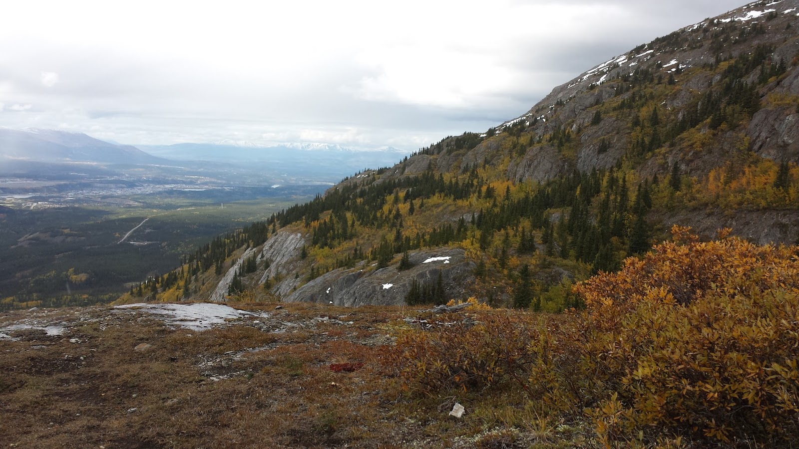
View of Whitehorse from one of the most northern ridges. 
We set up a vehicle shuttle, so we could avoid hiking along the dirt road at the end of this 7.5 hour hike. That way our energy was focused on the high-reward aspects of this impressive traverse.

Starting on the north side we had to climb about 200 m more in terms of elevation. That was well worth the effort: we ascended the ridge one intermediate summit after another, offering exquisite views and culminating in the highest summit on the south end.

One challenge was finding the up-track once the trail faded amongst the brush and many fallen trees. We were happy that Jeanne had loaded up a GPS track, so we could avoid backtracking as we meandered uphill. The bushwhacking and trail-finding was made more challenging by early season snow.

The view of the south summit of  Grey Mountain.
Once we gained the first high point, the view overlooking Whitehorse was immediately impressive. And it only got more so, as we headed further up on our south-ward trajectory and gained views from Lake Laberge to Marsh Lake and the mountains beyond.

We also got a fine view of the still snow-clad Mount Lorne.

Despite some threatening clouds we only got minimal rain on our final, steep descent on Money Shot. (To be sure, this seems to be typical sandbagging kind of name for a mountain bike trail.)
Wendy and Jeanne head toward the south summit of Grey Mountain.

In total, we ascended just over 700 m; a perfectly reasonable effort.

All in all a great day in the company of some very fine companions. Thanks Wendy and Jeanne!
This image doesn't do the fall colours justice. The yellows really popped
among the grey rocks and evergreens.

Hard to capture the mood of this moment with a smart phone camera.
Alas, it is what I got :) (with Yukon River)

Sunday, September 6, 2015

Hiking around Whitehorse: Mount Lorne

Our out and back track on the south side of Mount Lorne
  https://share.delorme.com/IngaPetri
I had made plans with a couple of new Alpine Club friends to head to Kluane's Bock's Lake and explore that area during the long weekend. But early snow, reported to be over one foot in those mountains and the potential for high water creek crossings due to snow melt, made that three-day trip seem a tad ambitous. Instead two of us opted for closer to Whitehorse hiking. Yesterday, we made our way to Mount Lorne.

Mount Lorne range viewed from the south.
The Mt. Lorne area has a long tradition of  First Nations people hunting and gathering. In fact, an archaeological dig at Annie Lake discovered remains of campsites dating back over 8,000 years.

Beautiful fall colours.
My hiking companion was hoping to confirm the route for a traverse of the Lorne ridge and a range just to the South. To that end she hoped to get up high enough on a col to get a look down at Monkey Creek. 

We couldn't get quite as far as far as anticipated, as we were clambering over, under and around fallen trees every 50 - 100 m for the length of the trail, and once up high we were post holing through at times knee-deep snow. Still we managed to ascend from about 770 metres at the trail head to 1,515 metres. And bonus, it was enough to confirm the traverse route in any case.

We had fantastic views to Marsh Lake and the full panorama of these mountains. It was a beautiful hiking day.


View toward Marsh Lake from our high point at 1,514 m (Click on images to view large)

Friday, September 4, 2015

Hiking around Whitehorse: McIntyre Creek

Looking for specimens 
in the marsh.
Gorgeous view from the bluffs 
above McIntyre Creek
How fun: I went on a biologist's quick field excursion to find some specimens for her labs at Yukon College this fall. I had driven down Fish Lake Road before, but never stopped along the way at any of the pull outs. I was happy to get to know McIntyre Creek with its high reward vistas, requiring little effort form the road. There are trails along the Creek as well as high on the bluffs.

Bonus: this creek is mere minutes from my house in Takhini North.
We saw many ducks and ravens along the creek. Environments
like this give true meaning to Whitehorse's moniker as 
The Wilderness City.