Sunday, November 15, 2015

Winter hiking near Whitehorse

I've been in Whitehorse since Friday. Happily I wrangled some hikes around town with some of my new Yukon friends and their Yukon dogs. There is snow everywhere, but in the higher elevations it is the best kind of winter. Super dry cold - can one ever moisturize enough up here?! - gorgeous fluffy snow on all the trees. A certain monochromatic whiteness and ever changing skies.

Dressing for this weather is much simpler than the damp cold in Ottawa and similar locales. Basically, with the right mix of performance clothing the cold stays outside; it just doesn't get into your bones. Also, there was no wind today. Wind makes such a ridge walk a whole different sort of experience. When we started the hike today it was probably around -18C or so. It felt fine and there was some de-layering needed on the uphill portion.

Our high point today was 1,507 m. We climbed 400 m from Fish Lake Road to the top of the ridge, according to my inReach. As Whitehorse is around 700 m, it doesn't conjure quite this wintry feeling, yet.

The scenery is crazy gorgeous. I mean it is stunning in the summer here but mind-blowing now. Check out today's Fish Lake hike up on to the ridge.

The view across Fish Lake from the ridge.

Walking along the ridge.

This Yukon dog really didn't appreciate standing still on
the snow.  Do check out the backdrop!
The human hiking pals, some I met a few months ago, some today.
That is how it rolls. 

Short breaks make for happy hikers.

Snow covered trees in the sunlight.

The Ridge. We are just above the treeline here.
Fun hike.

Monday, November 9, 2015

ACC Gazette published my story on Icefield Discovery

Full story:
http://acc.uberflip.com/i/594756-winter2015gazette
The Alpine Club of Canada's Gazette, the ACC trice yearly members' magazine, has just published my Icefield Discovery camp story in its Winter 2015 issue. And it made the cover, thanks to some fellow campers great photography! This one was more of a team effort, with ACCers contributing photos and offering edit suggestions on a draft text.

Read the full story and see more great pics here.

This is my third ACC Gazette article in the last few years. The other two are:
The Summer issue in 2014 detailing a trip to Bolivia's remote parts of the Cordillera Real and doing a first female ascent to Pico Aguila at about 5,500m.

The Winter issue in 2012 detailing one week of a 3 months Andean adventure focused on the stunning Cochamo valley in the Chilean Lake District in Northern Patagonia.

It's fun to spend this kind of time in some amazing mountains on this Earth of ours.

Wednesday, September 16, 2015

My first Yukon paddle: Chadburn Lake

My last evening in Whitehorse this September, a friend took me out for my very first paddle in the Yukon. As it was a post-work excursion we kept it simple: flat water kayaking on Chadburn Lake. This beautiful spot is within city limits in Whitehorse. I don't know if it ever gets busy there, but there were just three of us on his lake that evening. We paddled until dark and enjoyed visiting with a beaver, ducks and perhaps even a loon, and each other.

It was a perfect evening.

My ride with my ride - thanks to Up North Adventures for the kayak.
Reflections. Evening Light on Grey Mountain. 


Solitude and silence.

That's me on Chadburn Lake. Thanks for this cool photo! (by Kalin Pallett)

Light and dark as the sun begins to set.

Tuesday, September 8, 2015

Hiking around Whitehorse: Grey Mountain Traverse


Today's GPS tracking points.
https://share.delorme.com/IngaPetri
Today we spent another day hiking, bushwhacking and ridge walking. The objective: A north - south traverse of Grey Mountain ridge. I think traverses are always a really cool thing.

View of Whitehorse from one of the most northern ridges. 
We set up a vehicle shuttle, so we could avoid hiking along the dirt road at the end of this 7.5 hour hike. That way our energy was focused on the high-reward aspects of this impressive traverse.

Starting on the north side we had to climb about 200 m more in terms of elevation. That was well worth the effort: we ascended the ridge one intermediate summit after another, offering exquisite views and culminating in the highest summit on the south end.

One challenge was finding the up-track once the trail faded amongst the brush and many fallen trees. We were happy that Jeanne had loaded up a GPS track, so we could avoid backtracking as we meandered uphill. The bushwhacking and trail-finding was made more challenging by early season snow.

The view of the south summit of  Grey Mountain.
Once we gained the first high point, the view overlooking Whitehorse was immediately impressive. And it only got more so, as we headed further up on our south-ward trajectory and gained views from Lake Laberge to Marsh Lake and the mountains beyond.

We also got a fine view of the still snow-clad Mount Lorne.

Despite some threatening clouds we only got minimal rain on our final, steep descent on Money Shot. (To be sure, this seems to be typical sandbagging kind of name for a mountain bike trail.)
Wendy and Jeanne head toward the south summit of Grey Mountain.

In total, we ascended just over 700 m; a perfectly reasonable effort.

All in all a great day in the company of some very fine companions. Thanks Wendy and Jeanne!
This image doesn't do the fall colours justice. The yellows really popped
among the grey rocks and evergreens.

Hard to capture the mood of this moment with a smart phone camera.
Alas, it is what I got :) (with Yukon River)

Sunday, September 6, 2015

Hiking around Whitehorse: Mount Lorne

Our out and back track on the south side of Mount Lorne
  https://share.delorme.com/IngaPetri
I had made plans with a couple of new Alpine Club friends to head to Kluane's Bock's Lake and explore that area during the long weekend. But early snow, reported to be over one foot in those mountains and the potential for high water creek crossings due to snow melt, made that three-day trip seem a tad ambitous. Instead two of us opted for closer to Whitehorse hiking. Yesterday, we made our way to Mount Lorne.

Mount Lorne range viewed from the south.
The Mt. Lorne area has a long tradition of  First Nations people hunting and gathering. In fact, an archaeological dig at Annie Lake discovered remains of campsites dating back over 8,000 years.

Beautiful fall colours.
My hiking companion was hoping to confirm the route for a traverse of the Lorne ridge and a range just to the South. To that end she hoped to get up high enough on a col to get a look down at Monkey Creek. 

We couldn't get quite as far as far as anticipated, as we were clambering over, under and around fallen trees every 50 - 100 m for the length of the trail, and once up high we were post holing through at times knee-deep snow. Still we managed to ascend from about 770 metres at the trail head to 1,515 metres. And bonus, it was enough to confirm the traverse route in any case.

We had fantastic views to Marsh Lake and the full panorama of these mountains. It was a beautiful hiking day.


View toward Marsh Lake from our high point at 1,514 m (Click on images to view large)

Friday, September 4, 2015

Hiking around Whitehorse: McIntyre Creek

Looking for specimens 
in the marsh.
Gorgeous view from the bluffs 
above McIntyre Creek
How fun: I went on a biologist's quick field excursion to find some specimens for her labs at Yukon College this fall. I had driven down Fish Lake Road before, but never stopped along the way at any of the pull outs. I was happy to get to know McIntyre Creek with its high reward vistas, requiring little effort form the road. There are trails along the Creek as well as high on the bluffs.

Bonus: this creek is mere minutes from my house in Takhini North.
We saw many ducks and ravens along the creek. Environments
like this give true meaning to Whitehorse's moniker as 
The Wilderness City.

Sunday, August 2, 2015

Kluane's wild Donjek route

My Delorme in Reach tracking map for the Donjek Glacier. Square images mark start and end points on the Alaska Highway as well as our six camp sites during the trek.
From June 21 to 27 I hiked this impressive wilderness route that passes by the terminus of the Donjek glacier. It is located mostly in Kluane National Park with the remainder on the traditional territory of the Kluane First Nations. Max from Terre Boréale, a guide company in Whitehorse, Yukon, was my guide and companion for these seven awe-inspiring days.

We were the first ones on the Donjek route this year. When we registered at the Parks Canada visitor centre the warden was skeptical of our ambition to hike it in 7 days, as the normal time is between 8 and 10 days. Yet, permits in hand and undaunted we set out a little while later from the Alaska highway turnoff at the Duke River, just a few miles past Burwash Landing.

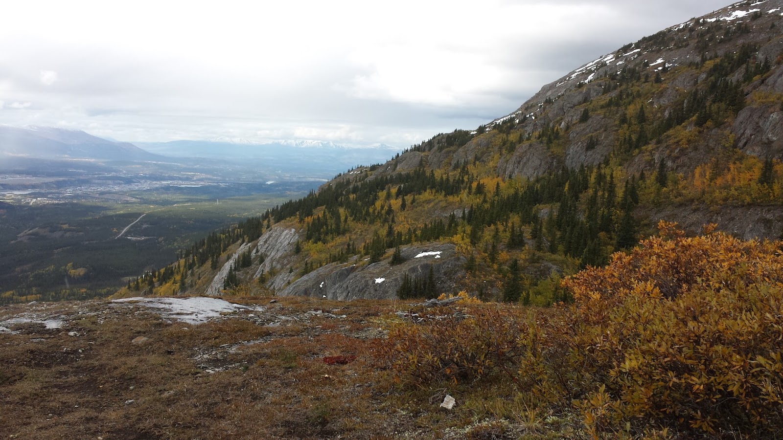
Day 1 - Burwash Uplands
We discovered quickly that the description we were using had a certain vagueness about it; but it did feature the occasional and very useful UTM coordinates which made route finding considerably easier. 
Camp 1 in Burwash Uplands. (Click on pics to enlarge)

The hike in from the road goes along an old mining road that most parties would drive up for 5+ km. We took that first hour as a warm up. Packs - filled with 9 1/2 days of food (just in case) and plenty of fuel, and the necessities for living in the wilderness - were at their heaviest, but the hiking felt easy. 

We met some hail and then mere rain in the wide open Uplands. Our rain gear worked well and we eagerly continued on our way.

The hardest part came when we finally left the old mining road which had become faint in parts after about 16 km and hiked across a very hummocky tundra. Here the going was very slow and squishy. After a 9-hour day we found a perfect camp site near a creek that set us up well for the next day.

Day 2 - Hoge Pass to Donjek River
Max starts down the scree.
We enjoyed an easy morning and a bit of a late start. Max and I were getting to know each other as hikers, and gauging how this day would set us up for either a 7-day trek or a longer one. 

We entered the national park, had a short break near the Warden's cabin and then headed up toward Hoge Pass. We'd gain considerable elevation and then we'd descent a long scree slope to get to Hoge creek. Route finding here was tricky as the description didn't assist much and there were several ridges to pick from for the descent. Concerned about getting cliffed out we took our time to look at maps and landscapes, knowing full well, that since we couldn't see the whole route anywhere, we might well need to be prepared for some challenges. In the end, we plunged down a scree field for about 500 m elevation loss that featured some of the most challenging terrain I'd been on. Certainly, this was not the route described. Some sections where beautifully easy with mostly packed sand to plow through even if it was  steep. But much of it had just that size rock on it, or was so hard packed that edging was impossible. I just focused on breathing and relaxing as I went.

When we got to Hoge Creek we found that water levels were lower than many others had warned us about. We crossed the creek only five (5) times and could rock hop, rather than ford it. 

We put up camp where Hoge Creek meets the mighty Donjek river. This day was about 9.5 hours; even though that included a long lunch at Hoge Pass to enjoy the scenery and a few shorter snack breaks. Good nutrition is all important when pushing long days with heavy packs. Also eating meant the packs got lighter!

Day 3 - Donjek Glacier
Heading toward the bushwhack section (Photo by Max)
This would be our easiest day of the whole hike. Just under 8 hours and we could hike along the Donjek river bed for a few hours before we needed to bushwhack up into the woods as the river filled the valley. We spent a couple of hours bushwhacking with the benefit of an old single track horse trail. 

Day 4 - Donjek to Bighorn Creek 
This was another easy day, spent sight seeing  at the Donjek glacier, listening to it heave and break and watching large chunks of ice fall into the river.
Max and the glacier.
Camp 3 - overlooking  the glacier (Photo by Max)

It was such a beautiful day and the hiking was easy. The biggest challenge for lunch was to find a bit of clear creek water for cooking. Many of the creeks on the map were in fact dry, or water would surface for short sections only to go underground again. We eventually found a nice lunch spot.

The ultimately biggest challenge of this day however was crossing Bighorn Creek in the afternoon. Its water ran high and it fell to Max to find good crossing spots. We spent over an hour navigating back and forth as we got cliffed out repeatedly. 

I learned a lot about safely crossing fast moving, big waters; Max and I became a good team as we settled into our creek crossing grove.

We also decided to try the Bighorn Creek Canyon, a very narrow section, first thing the next morning when the water would be at its lowest. It had become clear, that it would be impassable otherwise (which would force us into a long detour via Expectation Pass) as the water rose by well over a foot through the day.

Day 5 - Bighorn Creek Canyon to Atlas Pass to Duke River
This was to become an epic day.
Afternoon crossing of a very big Bighorn Creek. Way back,
that is Max stacking his stuff to come and cross with me.

Our 4:50 am start saw me nearly 'eat it' within minutes in the frigid creek when the force of the water, still above knee high, and the rolling rocks conspired so that I lost my footing. Happily, I could grab Max' arm and got myself back up as he held on. Wow. I was all awake now! 

We carried on, moved forward and just had to cross the creek one more time. Eventually I noticed blood running down my leg and my shin and knee ballooning with some large bruises. But since the water was so cold, I never felt a thing.
Circling with the grizzly bears; they are in the background
at the edge of the plateau to the right of me. (Photo by Max)

From here we headed up Chert Creek, where we changed out of our creek crossing shoes and warmed up with a 6 am breakfast and coffee! 

By 8:30 am we had topped out at the plateau near the head of Chert Creek and promptly sighted a grizzly bear and her cup heading for us. We stayed calm as they were feeding and ended up circling toward us, while we circled out of the area. We had some amazing close views of both bears but were happy that they simply went about their business and weren't disturbed by our presence. We hiked up a ways toward Atlas Pass and took a break after all that excitement.
Nearing Atlas Pass (Photo by Max)

Continuing upwards to Atlas Pass was beautiful as we moved through green hillsides and into the vegetation-free alpine. We gained about 1,000 m elevation by lunch. 

And what a stunning place to have lunch!

Bonus: this was the first day the thick haze from forest fires cleared and we were able to see mountain ranges deep into
Lunch at Atlas Pass enjoying stupendous views. (Photo by Max)
Kluane, toward the Icefield.

We had a nap after lunch to gather energy and our wits for an epic scree descent and long hike toward the Duke River. This descent was described in very precise detail, which suggested to us that there really is just one safe way down! We stuck to the description, including the Hole 9 green - it is quite something when you see that patch of green suddenly!

The descent and hike out toward the Duke river took about 13 hours. But then came the sprawling beaver ponds along the Duke. We got wedged in on the mossy, wet and steep forest side and we ended up bushwhacking for an
Heading up on Atlas Pass to get to scree entry. (Photo by Max)
hour before deciding to cross the beaver pond in search of dry land. Happily Max found just that and 14.5 hours after the day's start we set up camp and contemplated the fact that we were indeed moving at a very fast pace and would get back to the Alaska Highway and our van well within 7 days!

Day 6 - To Copper Joe Creek

This day was supposed to be a normal hiking day: cross the Duke in a safe spot, hike along it for a few more kilometers and then head up to the saddle and drop to Cache Lake to camp.
Me on that last bit of  vertical scree.
The key: just keep on moving fast!
(Photo by Max)

Well, it got a little more interesting when we couldn't locate the 'faint path' that was once a mining road and instead bushwhacked through thick brush from the river to the saddle. Max' way-finding made sure we kept moving forward and upward with purpose; handily dispensing with the willows and shrubs and stopping for the views when we came out of the woods. We got to Cache Lake early enough to just take a break and then hike along Copper Joe Creek to gain a little time on our last day. Unfortunately, the creek bed was completely dry! So rather than going just a little further we ended up with a bit of a hike as our water supplies dwindled.

We were happy to get to the first sign of water in that creek quite a ways down and set up our final camp. 

Day 7 - to the Highway
We didn't have much hiking left to do and reached the highway by noon. Unlike other people, we had our one vehicle on the other side of Burwash Landing about 15 km along the Highway. With no luck hitchhiking we ended up walking nearly into Burwash before a truck stopped and we jumped in the back. This made very short order of those final 10 km.
Duke River vistas. (Photo by Max)

They say this is a serious wilderness route and it is: impressive creek crossings (even as we had quite low flows for some of them), fantastical mixed scree descents off Hoge and Atlas passes, bushwhacking through thick vegetation (thankfully sometimes aided by game trails and an overgrown horse trail) and finding your own way in a truly wild and remote place. This trek has it all and demands it all. 

I loved every moment of these six and half days with Max and Terre Boreale.

Next up: more Yukon mountain excursions and then the Andes and an attempt on Aconcagua. (I hope!)

Tuesday, June 23, 2015

inReach message from Inga Petri

We're camping at Hoge creek at Donjek river tonight. Another 9.5 hours of some hard hiking. About 38-40k covered in 2 days. Beautiful land!

View the location or send a reply to Inga Petri:
https://explore.delorme.com/textmessage/txtmsg?mo=bfe5b496a7ac471e8a3c77add6753bce31608966&adr=strategicmoves1.trails%40blogger.com

Inga Petri sent this message from:
Lat 61.277983 Lon -139.614365

This message was sent using the DeLorme inReach two-way satellite communicator with GPS. To learn more, visit http://www.delorme.com/inReach/

Saturday, June 13, 2015

Yukon's Mighty Icefields

Well. What can you say about this massive icefield?

From May 23 to June 9 I was part of an Alpine Club of Canada Yukon (ACC) trip. Some people stayed for 4 days, some for a week and a few of us for the whole duration. The ACC Icefield Discovery camp was supposed to be two weeks (May 23 to June 6), but weather and massive clouds extended that for some of us by 3 days and for others by 5!

Anyways, words defy this "trip-of-a-life-time" landscape (haha, it's my roughly annual trip of a lifetime and only Part 1 at that...) In any case, let me show you this place with a few pics taken by Erika Joubert, an awesome camp mate and chum. Click on pics to see them larger - it's worth it!

My own pictures are on a camera and Samsung Android phone that are both still in the Yukon with all of my gear. When we finally got a flight out on the 9th day of no flights, we had decided to get people out and leave gear behind for later pick up. All to say, there'll be more pics soon, as I am heading back to resume Yukon 2015 Part 2 with trekking, festivals and visiting friends.

Gnurdelhorn (~3,350 m) and Queen Mary (~3,900 m)
Icefield Discovery camp is to the right of Gnurdelhorn. It has two
weather haven tents - one for kitchen, one with a half for gear
and the other half sleeping. And a few tents.

Week 1 was hot. Measured 27 C in the sun one of these days,
and that wasn't the hottest one! Needless to say, the earlier
we got to ski the better the snow was. Except it did get
super soft, super fast. Not the sort of conditions
this Eastern  Canadian, icy ski slope skier knows how to handle.

Classic: mountaineer's pose - lol.

Massive Mount Logan, Canada's highest mountain (5,959 m) and the
largest in the world by sheer mass, was our steady companion,
and our  mark for cloud movements of sorts.
 Even though, it's 40 km away.
This is the sun starting to set for a little while.
 Once I get my camera I will post
pics from a very cool flight seeing trip a few of us did
before the weather turned on us.

My first trip to Pikatak while the weather was warm
and the clouds few. This was taken by Laura Storch
a few feet below the summit.
Gnurdelhorn is in the background.


Pretty cushy beach life. It was so hot, people were all about
sun protection. Granted on a glacier at about 2,600 m there's
plenty of reason to try and keep sun radiation at bay.

Week 2 we were weathered in. A couple of stormy days with some
good winds, but it was mostly due to a fast moving wall of cloud
and tiny weather windows, that there were no flights.
Icefield Discovery managed one flight out on the 9th day (3 days
later than the final intended day at camp) and the rest
of the crew got picked up another 2 days later
after getting though another storm.
This picture was taken around 5:30 am and the skies were clear.
The sun came up right over the col at MB Peak from our vantage point.
Within a couple of hours we were socked in again.
We ended up making the check in time with the pilot earlier
as the best windows were that kind of early.

We did get out on a few excursions as the weather wasn't bad.
Isothermal snow (super wet spring snow) notwithstanding.
This is me on the way back up the glacier from Pikatak to camp;
enhanced by clouds.


See that pool below? All kinds of talk around camp about
going for a dip in there when it was hot out.
Here we are heading up the slope of Pikatak to the summit.

Despite the long period without any flights and no way out, folks
maintained their good humour. This is a very large "Hi Tom"
(that is Captain Tom, our long-awaited Helio pilot) stamped
out repeatedly as the snow kept drifting over it.