Sunday, September 23, 2012

Fredericton river trails

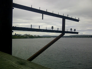
Work travel does allow sometimes for at least a decent walk about. Downtown Fredericton proved particularly rewarding: the mighty Saint John River runs through it, historic military buildings turned museums, galleries and art studios are situated between river and a surprising selection of good restaurants. And best of all, there are many excellent, wide pathways for walkers, cyclists or skaters.

A retired train bridge has been turned into a gorgeous trail connecting both parts of the city, and a number of waterfront and city trails. While these images don't show people be assured that took effort. The locals and visitors both enjoyed their Sunday strolls or training runs on these beautiful paths. These few impressions present the pervasive nature that makes the New Brunswick capital such a pleasant place.


Monday, August 27, 2012

Day 4 - riding out


Jan and horse on meadow.


The riding on day 4 was easy - the same way out, without any new blow down. The ride took only about 3 hours and was largely uneventful.

By now I was used to Jordi not liking bridges, so we simply found ways around them through the rivers and creeks.

Here are a few more impressions from horse camping in the Yoho back-country.
Afternoon sun and cloud spectacle.

Inga looking pretty comfortable in a saddle even on
 the fourth day. Jordi's a great trail horse.

The warden's cabin on the small meadow.


The awesome river right below the cabin.
Goodsirs in background.


At the end of the trail, we find the trucks and horse trailers.
Here's Jan helping with the saddles and getting the horses
into the trailers for the ride home.


Sunday, August 26, 2012

Day 3 - Bushwhack!

After a couple of days of camping at Ottertail camp it was clear that there's not enough grazing for the horses for 3 days. It was also clear that the last 2 days of riding had been tiring and most of us were ready for an easier day.
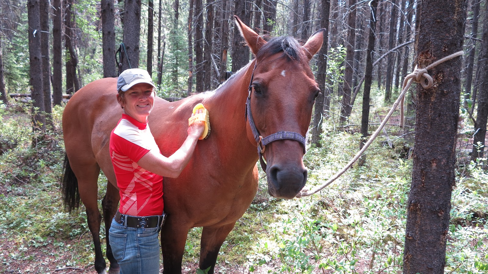
Jan's happy taking care of the horses. She's also good at it.

Big Al and Dave in the kitchen.

Us at the edge of Ottertail Falls

Bushwhacking on horseback was a new kind of experience.
Wow!

So we rode up to Ottertail Falls and then attempted to access the river near camp via an old telephone route to the Cabin. The bushwhack was just that. Both horse and rider had to handle all manner of jumbled trees and the footing was progressively softer. In the end, we decided that this old route was not going to be feasible and turned around to head back to camp. It ended up being a shorter then hoped for riding day (just under 2 hours), but such is the nature of exploration.

You can lead a horse to water but ...
Jan and Al taking a couple of horses down to make sure they
are well hydrated.
Enjoying the afternoon at our private river hideaway!
Al and Dave brought the horses to a grazing spot across the river from the Warden's cabin so they'd be well fed and watered for our ride out the next day.

Saturday, August 25, 2012

Day 2 - Heading to Good Sir Pass

From our camp to Goodsir Pass, part of the famous Rockwall Trail, was just over 9 km one way. Today, would be a big day for us city gals.

Jan's happy and looking good on Bo.

Single track. Our guides were dealing with
trail clearing quite adaptly. Pays to have retired
Park Wardens as guides.
Leaving the fire road we were now riding on single track. It's obviously not a much travelled area, Al and Dave did lots of trail clearing of blow down. Some small and a quick axe job sufficed. Others sizable B.C. trees requiring knowledgeable saw work. Al and Dave handled all with aplomb.

We got to be tourists and wait from them on our horses. The horses, of course, took any opportunity to eat grass and some leaves during these frequent breaks. We reached the Pass after about 3.5 hours; after some steep climbing our horses had to do. We supported them as best we could, making our riding lessons count.

While there was plenty of grazing for the horses, there was no water for them. So we had a well earned rest, some lunch and got on our way back down.

Upon our return we got to a river we had crossed in the morning. Now, Al said, let your horses drink! And they did. We got back to camp after an awesome and exhausting riding day with about 6 hours logged!

Jan at our lunch spot with awesome mountain views.
While it's definitely easier to ride a horse up here than hike
with backcountry gear, it's still a great workout! 

Our horses get a break and graze to their heart's content.

Awesome views over the glaciated Goodsirs. They are
impressive at up to 3,500 m high.


Friday, August 24, 2012

Horses! Day 1

We'd already posted about heading to Bear Corner Breakfast and Bale. Now here are day-by-day posts on the 4 days riding in Yoho National Park. We quickly learned that this was an "exploratory trip." With the rain this spring and summer in B.C. Al's normal trail for a multi-day excursion was washed out; only the first 17 km are passable by car leaving us 33 km short of the trail head. Al needed another option for us.
Inga on ride in - took about 4 hours total due to all the
trail clearning required. I was on Jordi (Jordan), a great
horse for me.

Jan's riding in on Peach. The other days
she was on Bo. All fine horses with  varying
degrees of liking / dis-liking mad-made
structures like bridges.

Being a former warden, he made some calls and got a backcountry permit for our whole team, 4 people, 6 horses, including grazing permits in Yoho National Park. Having already hiked to Lake O'Hara in Yoho we were excited to experience some of the less trodden paths.
The horses were tied to trees for saddling/ un-saddling.
Other than that they had free reign in the meadow.

Our excursion was a little inauspicious as we drove in thunder and rain to our trailhead at Ottertail Trail,  located a few kilometres before Field, B.C., and the Lake O'Hara trailhead/road. By the time the 6 horses were saddled and packed and we got going, the rain had subsided and the weather began to clear.

At camp. Make-shift saddle storage.
We rode in 15 km. Al and Dave, our guides, smartly brougth both an axe and a Stihl saw. There was quite a bit of blow down to clear. This trail is an old fire road. We learned that the National Park Service was initially focussed on fire fighting and prevention, hence this infrastructure. Today they use helicopters to fight fires, making fire roads obsolete.

Even though the fire road is being reclaimed by nature, it still made for a relatively easy horse trail. This being the first day in the saddle and just getting to know the horses that was great.

Our team on the meadow. Al actually built the coral you
can see in the background back in his warden days.
To keep the horses close, all we needed
to do was to put 2 of them into the coral. The
others would stick close by. A rope across the path
did the rest.
We set up camp in the designated backcountry camping area near the Park Warden cabin. Around the cabin is a small meadow where the horses would graze and the camping and cooking/food storage areas were well divided for bear safety reasons.

We had a fine dinner, got the horses settled in and called it an early night.

Thursday, August 23, 2012

Rest Day!

Kicking Horse is a fun skier's resort mountain.
Riding the gondola in summer is way different than in winter
when we have all the gear and warm clothes.
Rest day means we took the gondola up Kicking Horse Mountain Resort :)
Here are a few more pics from that day, just to complete our earlier Blackberry post.

Also, while the food at the GMC was exceptional in any context, it was fun to have the full service experience at Eagle's Eye Restaurant at the top of the resort.

Our waitress was both funny and unobtrusive. And Jan made the gondola and lunch a present for having come to this fine country back on August 6, 1988.


Black diamond hiking trail from top of the gondola. Priceless.

At Eagle's Eye:
Green tomato gaspacho with scallop ceviche was awesome.

Scallops with bacon proved a worthy main. Thanks for the
24th anniversary in Canada celebration, Jan!

Wednesday, August 22, 2012

Lake O'Hara and Lake McArthur

Right after GMC we went to Lake O'Hara to spend that Sunday with friends from Toronto. The busses were full, so our only option was to hike in on the road. It's supposed to be 13.65 km or 11 km (we've been told both by authoritative sources - I'm going with 11km) and gain about 500m in elevation. Still, we managed it in two hours. The hike felt easy. We thought there were just a few steep sections.

Lake O'Hara. Jan's new Canon takes really nice pics.
Our friends had been told it would take us three hours so we had a bit of time to get a coffee and sit by Lake O'Hara awaiting their return from a short morning jaunt.

We decided to head up the short hike to Lake McArthur, which is really the postcard lake! It was a lovely hike up with plenty of catching up and storytelling along the way.

Lake McArthur. Even in the early afternoon it was calm,
allowing for those signature reflections of mountains.
Local wildlife boldly visited us at our rocky lunch spot.
We talked bears and mountain goats, mountains, lakes and icebergs.

We returned with a couple of hours to spare before the last bus at 6:30 pm would take us back to the road. We joined our friends for "happy hour" by the lake (so civilized) and then sadly had to get on our way.

Mountain goat. This was a mythical appearance on top
of the cliff near McArthur Valley.
When we boarded the bus, we were happy not to hike it out. Then a couple of kilometers into the ride, we suddenly looked at each other, realizing that the whole way so far had been downhill and quite steep.

We started laughing; amazed that we had interpreted the road as flat in the morning, when it so clearly isn't. I usually have great dislike for things like head winds and uphills (go figure!). This time, though, I think the training of a week at GMC set even me up to motor on this uphill like it's nothing!


Tuesday, August 21, 2012

GMC - Jan's Alpine Helicopter video

Flying by helicopter was a first for both of us. Jan got the front seat for the flight out to take this video. I've edited it for length and then created a lower resolution file out of this 1+gigabyte video. Check it out. (We have the full screen HD version; you can always come by our place for the full-on experience.)

GMC - Flying out August 4

Flight out and camp crew (Photo by Nataliya).
Chucky, Matt, Jen, Jeff (behind), Andrew, Ron and
 Julius (standing). Plus Jan and I at the helipad.
Packing up and flying out. That was sad.

The participants on this week worked very well together; lots of generosity and kindness, as well as skill, smarts and patience was on display all week.
Plants near the helipad.
Tea tent. Aptly named.

Where we did dishes. An ingenious set up.
We were on the second of nine flights, but still had plenty of opportunity to loiter about and take some extra pictures. (Just click on an image to see it large; then hit the back button in your browser.)

We came to the GMC to learn more skills and spend time with experienced mountaineers in this awesome landscape, as part of preparing ourselves for new objectives. We got that and more.

We are making plans now for our next big trip. I am sure they will be bold ones. Meanwhile, I am working on my mission (just like camp doc Ron's parting words implored) to get into great shape for these mountain pursuits.

It's time to apply the same vigour to the physical training as I have been applying to other aspects  such as learning Spanish (that's like a whole new language!) these past 2 years as part of trip prep.

Without doubt, details will be posted here as they unfold. I am quite certain that whatever the specifics, speaking Spanish will be a plus :)
Our last morning. Glorious weather greeted us along
with the moon over the Haworth glacier and Redan.


Monday, August 20, 2012

GMC - August 3 - Azimuth Mountain

On the Silvertip glacier looking toward Silvertip mountain.
The Adamant glacier looking toward
Adamant range from Azimuth.
This, our final climbing day had a couple of rope teams heading for Azimuth. Jan was on Jeff's team, while I was on Brenda's together with Renee (back-country cook extraordinaire!) and Angelika. Our team took things a little more leisurely than Jan's ;)
Brenda leading Renee, Angelika and Inga up the ridge.
The route to Azimuth included that same snow field and steep scramble on loose rock to get to the Silvertip glacier. Then we crossed the crevassed glacier and got onto the long rock ridge. There were a few climbing moves, lots of exposure and awesome vistas. The weather again held up, despite a few moments of dark clouds swirling in. In the mountains weather can change dramatically in either direction: toward scary or toward gorgeous.

The benefit of being on different teams - pictures.
This one of my team near the summit.

Jan's team included Alisen, Julius and guide Jeff. A couple of
minutes after these pics we were all on the summit :)


Julius and Alisen, part of Jan's rope team,
 doing the Azimuth summit dance.